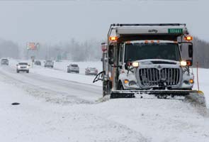
National Weather Service officials in Kansas issued blizzard warnings and watches through late Monday ahead of the strong storm system that's packing snow and high winds. The storm has been tracking across western Texas toward Oklahoma, Kansas and Missouri.
"We're expecting more wind with this storm," said Jeff Johnson, meteorologist with the National Weather Service in Dodge City, Kan. "Snow amounts are varying, but we could see upward of a foot across south-central Kansas with lesser amounts across west-central and central Kansas."
"This storm has the potential to be more dangerous than last week's storm," said Brownback, who held a briefing Sunday night along with emergency officials in his state to warn residents about the weather.
He urged motorists to "stay off the road unless it's absolutely critical" but said drivers who must travel should pack their charged cellphones and emergency kits containing food, water, blankets, road flares and shovels.
The region was hit by a massive storm last week that dumped a foot of snow in some sections, closed airports and caused numerous accidents.
"It would have been nice if we'd had a few days to recover, to do some equipment rehab," Joe Pajor, deputy director of public works in Wichita, Kan., told The Wichita Eagle. The city saw its second-highest snowfall ever Thursday with 14.2 inches.
Other totals from the Thursday snowstorm included 18 inches in the southern Kansas town of Zenda, 17 inches in Hays, Kan., about 13 inches in northeast Missouri and 12 inches of snow in parts of Kansas City.
Steve Corfidi, meteorologist with the National Weather Service's Storm Prediction Center in Norman, Okla., said the storm also will affect southern states and could spawn tornadoes Tuesday in Louisiana, Mississippi, Alabama, the Florida Panhandle and Georgia.
"It definitely will be one of the more significant events of the season, the winter season, absolutely," Corfidi told The Associated Press. "Both in winter weather and severe weather potential, and rain, down in the southeast United States."
More than a foot of snow is possible from the Texas Panhandle, across the Oklahoma Panhandle and into Kansas and possibly Missouri as the storm moves eastward from the southwestern United States.
While snowfall is expected to taper off by Monday afternoon, wind gusts of up to 35 mph will remain a hazard, said Sarah Johnson, a meteorologist in the National Weather Service's Amarillo, Texas, office.
Pajor told the Wichita newspaper the new storm "looks worse than the last one" and that sand and salt supplies are low because of last week's record storm, as are the number of locations where snow can be transported off city streets. He said the plowing strategy for the new blizzard may have to involve plowing snow into the center of arterial streets, and cutting traffic to one lane each direction.
He also said streets won't be treated with the city's limited sand and salt supplies until the snow ends and plowing is under way.
The threat of the pending storm forced cancellations Sunday and Monday in Kansas and Missouri, including the championship basketball tournament for the Kansas Collegiate Athletic Association, which rescheduled the tournament for Tuesday in Park City, Kan.
Matt Lehenbauer, emergency management director for Woodward County, Okla., said he expected rain or snow to begin there Sunday evening and forecast up to a foot of snow and wind gusts up to 50 miles per hour.
"We're expecting white-out conditions," he told the AP.
He said there is plenty of salt and sand on hand to help clear roads, but the conditions may cause delays.
"We may not get the roads cleared until midday Tuesday if we get the expected amount of snow and wind. As it's falling, in the blizzard-like conditions, we just won't be able to keep up," he said.
No comments:
Post a Comment